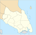
Imådje:Johor location map.svg

Taille de cet aperçu PNG pour ce fichier SVG : 629 × 599 picsels. Ôtès fintés: 252 × 240 picsels | 504 × 480 picsels | 806 × 768 picsels | 1 075 × 1 024 picsels | 2 150 × 2 048 picsels | 1 035 × 986 picsels.
Fitchî d’ oridjinne (Fitchî SVG, finté di 1 035 × 986 picsels, grandeu: 65 Ko)
Istwere do fitchî
Clitchîz so ene date ey ene eure po vey kimint ki l’ fitchî esteut adon.
| Date/Eure | Imådjete | Grandeur | Uzeu | Comintaire | |
|---|---|---|---|---|---|
| asteure | 13 djanvî 2018 à 13:12 |  | 1 035 × 986 (65 Ko) | Goran tek-en | {{Information |description ={{en|1=A map showing districts and PBT (local authorities) of Johor (blank version)<br> Approximate geographic limits of the map: *N 3.108806 *W 102.365112 *S 1.270019 *E 104.61731}} |date =20180113 |source... |
Eployaedjes do fitchî
I n’ a nole pådje k’ eploye ci fitchî ci.
Eployaedje tot avå do fitchî
Les ôtes shuvants wikis eployèt c’ fitchî ci :
- Eployaedje so en.wikipedia.org
- Johor Bahru
- Pasir Gudang
- Rawa Island
- Pemanggil Island
- Besar Island, Johor
- Kukup
- Mersing
- Labis
- Senai International Airport
- Iskandar Puteri
- Ayer Hitam
- Yong Peng
- Sultan Abu Bakar State Mosque
- Pasir Pelangi Royal Mosque
- Sultan Ibrahim Jamek Mosque
- Pasir Gudang Jamek Mosque
- Jementah
- Parit Raja
- Bandar Tenggara
- Tampoi, Johor
- Perling
- Bukit Kepong incident
- Air Panas
- Kempas
- Mengkibol
- Tenggaroh
- Sagil
- Sungai Mati
- Parit Bakar
- Semerah
- Sri Medan
- Sungai Balang
- Sultan Ismail Jamek Mosque
- Bandar Baru UDA Jamek Mosque
- Tanjung Kupang
- Gemas Baru
- Tongkang Pechah
- Ungku Tun Aminah Jamek Mosque
- Kolam Ayer Mosque
- Lima Kedai
- Senggarang, Johor
- Sri Gading
- Wikipedia:WikiProject Malaysia/Cartography
- Seelong
- Kangkar Pulai
- Tebrau
- Pulau Merambong
- Taman Sri Lambak
- Muar (town)
- Batu Pahat (town)
Loukîz di pus so l’ eployaedje totavå di ci fitchî ci.
