Imådje:Saskatchewan-map.png
I n’ a nén di pus grande finté.
Saskatchewan-map.png (280 × 230 picsels, groxheur do fitchî: 15 Ko, del sôre "MIME": image/png)
Ci fitchî ci provént d’ Wikimedia Commons ; si pout i esse eployî divins des ôtes pordjets Wiki. Li discrijhaedje di si pådje di discrijhaedje låvå est håynêye cial ådzo.
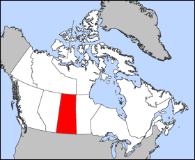
Map of Saskatchewan
Projection: Lambert azimuthal equal-area
Geospatial data from: The Atlas of Canada, The National Atlas of the United States and U.S. Geological Survey
Cartographer: John Fowler
| Moi, propriétaire des droits d’auteur sur cette œuvre, la place dans le domaine public. Ceci s'applique dans le monde entier. Dans certains pays, ceci peut ne pas être possible ; dans ce cas : J’accorde à toute personne le droit d’utiliser cette œuvre dans n’importe quel but, sans aucune condition, sauf celles requises par la loi. |
Istwere do fitchî
Clitchîz so ene date ey ene eure po vey kimint ki l’ fitchî esteut adon.
| Date/Eure | Imådjete | Grandeur | Uzeu | Comintaire | |
|---|---|---|---|---|---|
| asteure | 24 måss 2005 à 12:18 | | 280 × 230 (15 Ko) | Voyager | Map of Saskatchewan Projection: Lambert azimuthal equal-area Geospatial data from: [http://atlas.gc.ca/ The Atlas of Canada], [http://www.nationalatlas.gov/ The National Atlas of the United States] and [http://www.usgs.gov U.S. Geological Survey] Carto |
Eployaedjes do fitchî
Li pådje shuvante eploye ci fitchî ci :
Eployaedje tot avå do fitchî
Les ôtes shuvants wikis eployèt c’ fitchî ci :
- Eployaedje so bat-smg.wikipedia.org
- Eployaedje so br.wikipedia.org
- Eployaedje so en.wikipedia.org
- Eployaedje so en.wiktionary.org
- Eployaedje so eo.wikipedia.org
- Eployaedje so frr.wikipedia.org
- Eployaedje so gd.wikipedia.org
- Eployaedje so hu.wikipedia.org
- Eployaedje so hu.wiktionary.org
- Eployaedje so io.wikipedia.org
- Eployaedje so kw.wikipedia.org
- Eployaedje so lij.wikipedia.org
- Eployaedje so nn.wikipedia.org
- Eployaedje so pam.wikipedia.org
- Eployaedje so pms.wikipedia.org
- Eployaedje so sc.wikipedia.org
- Eployaedje so sh.wikipedia.org
- Eployaedje so ta.wikipedia.org
- Eployaedje so uk.wikipedia.org
- Eployaedje so vo.wikipedia.org
- Eployaedje so xmf.wikipedia.org
- Eployaedje so zh-min-nan.wikipedia.org