Imådje:Location Ardennes.PNG
I n’ a nén di pus grande finté.
Location_Ardennes.PNG (506 × 439 picsels, groxheur do fitchî: 40 Ko, del sôre "MIME": image/png)
Ci fitchî ci provént d’ Wikimedia Commons ; si pout i esse eployî divins des ôtes pordjets Wiki. Li discrijhaedje di si pådje di discrijhaedje låvå est håynêye cial ådzo.
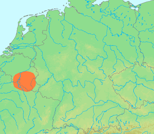
| Discrijhaedje | Locator maps for mountain ranges : Location Ardennes.PNG |
| Sourdant | demis maps, see below |
| Oteur | 13:44, 29 June 2007 (UTC) |
This image is in the public domain because it came from the site https://www.demis.nl/products/web-map-server/examples/ and was released by the copyright holder. Permission is granted to copy, distribute and/or modify this map since it is based on free of copyright images from: www.demis.nl. See also approval email on de.wp and its clarification.
|
| This work has been released into the public domain by its copyright holder, www.demis.nl. This applies worldwide. Dans certains pays, ceci peut ne pas être possible ; dans ce cas : www.demis.nl accorde à toute personne le droit d’utiliser cette œuvre dans n’importe quel but, sans aucune condition, sauf celles requises par la loi.
|
Istwere do fitchî
Clitchîz so ene date ey ene eure po vey kimint ki l’ fitchî esteut adon.
| Date/Eure | Imådjete | Grandeur | Uzeu | Comintaire | |
|---|---|---|---|---|---|
| asteure | 29 djun 2007 à 13:42 | | 506 × 439 (40 Ko) | Michiel1972 | {{Information |Description=Locator maps for mountain ranges : {{subst:PAGENAME}} |Source=demis maps, see below |Date= |Author={{Statistics Netherlands map}} |Permission=see below |other_versions= }} {{PD-Demis}} [[Category:Maps of mountain_ranges_of_Eu |
Eployaedjes do fitchî
Li pådje shuvante eploye ci fitchî ci :
Eployaedje tot avå do fitchî
Les ôtes shuvants wikis eployèt c’ fitchî ci :
- Eployaedje so af.wikipedia.org
- Eployaedje so ar.wikipedia.org
- Eployaedje so arz.wikipedia.org
- Eployaedje so be-tarask.wikipedia.org
- Eployaedje so ca.wikipedia.org
- Eployaedje so ceb.wikipedia.org
- Eployaedje so cs.wikipedia.org
- Eployaedje so de.wikipedia.org
- Eployaedje so de.wiktionary.org
- Eployaedje so en.wikipedia.org
- Eployaedje so eo.wikipedia.org
- Eployaedje so es.wikipedia.org
- Eployaedje so eu.wikipedia.org
- Eployaedje so fy.wikipedia.org
- Eployaedje so hy.wikipedia.org
- Eployaedje so ia.wikipedia.org
- Eployaedje so incubator.wikimedia.org
- Eployaedje so is.wikipedia.org
- Eployaedje so ja.wikipedia.org
- Eployaedje so ko.wikipedia.org
- Eployaedje so li.wikipedia.org
- Eployaedje so lt.wikipedia.org
- Eployaedje so ms.wikipedia.org
- Eployaedje so pcd.wikipedia.org
- Eployaedje so pl.wikipedia.org
- Eployaedje so pl.wiktionary.org
- Eployaedje so pnb.wikipedia.org
- Eployaedje so simple.wikipedia.org
- Eployaedje so sk.wikipedia.org
- Eployaedje so sv.wikipedia.org
- Eployaedje so th.wikipedia.org
- Eployaedje so uk.wikipedia.org
- Eployaedje so www.wikidata.org
- Eployaedje so zh-yue.wikipedia.org
- Eployaedje so zh.wikipedia.org